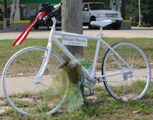
Va Beach City Council member Rosemary Wilson recently introduced a resolution which recognizes the safety and other advantages of on-road bicycle accomodations, ie. bike lanes, wide curb lanes, shoulders, or signed/marked shared roadways.
Most importantly, it also signifies council's support for inclusion in future major road improvement projects where ever feasible, as well as a look at and backfit of on-road bike facilities within existing roadways. This would be done in a cost effective manor on a priority basis determined by the Public Works department in consultation with the Bikeways and Trails Advisory Committee.
The resolution is on council's agenda for a vote on Tuesday, August 25th at 6pm. Council chambers are located at City Hall Bldg 1, second floor.
This is the moment we've waited on for nearly two decades. It is a giant leap toward a better cycling environment in VB. However, to get the resolution passed we need a significant show of support from each and every cyclist in the city.
Please come show your support for on-road bike facilities at Tuesday's council session. Let's fill every seat and the adjacent hallway too. I am working on two or three speakers on behalf of the resolution in the event it doesn't make the consent agenda.
Ride safe and I hope to see everyone at City Hall this Tuesday night!
Bruce
p.s. Questions or concerns- please contact me at 757.647.3987 or mailto: hrcyclist@cox.net.
8.20.2009
Resolution recognizing bicycle accomodations will be presented to City Council on August 25th
A GPS run/walk/ride as an idea for an event
Running, walking, riding, sharing and arting as an idea for an event that includes gpsin'.
This sounds cooler than geocaching.
Everytrail.com:
How cool & appropriate would it be to include this in our Columbus Day Weekend event?
This sounds cooler than geocaching.
Part sport, part art, GPS drawing lets runners, walkers, cyclists and hikers imagine themselves... neo-cartographers, jumbo-size doodlers and bipedal pencils, mapping their track lines[.]Article at NYTimes.com.
Everytrail.com:
With EveryTrail, sharing your trip experiences has become a lot more fun: using a GPS device you can easily plot the exact path you traveled on an interactive map, with your photos positioned on the map at the exact location you took them.A cool gallery of someone doing this for 10 years.
How cool & appropriate would it be to include this in our Columbus Day Weekend event?
Subscribe to:
Posts (Atom)